 FloodRadar
Log inCreate free account
FloodRadar
Log inCreate free account
15–16 October 1987 · named by historic · England
Did this storm flood you? Log it
| Gauge | Total mm |
|---|---|
| Brynberian, Tafarn-Y-Bwlch · Dyfed · Met Office · includes 2 estimated days | 148.5 |
| Waen Sychlwch · Dyfed · Met Office | 147.7 |
| Troed-Y-Foel · Dyfed · Met Office | 145.0 |
| Thirlmere, Nook · Cumbria · Met Office | 141.4 |
| Upper Usk No 1 · Dyfed · Met Office | 140.1 |
| Llyn Fawr Resr No 1 · Mid Glamorgan · Met Office · includes 2 estimated days | 134.6 |
| Dale Head Hall · Cumbria · Met Office | 130.7 |
| Cowlyd · Gwynedd · Met Office · includes 2 estimated days | 129.4 |
| Mathry, Llain Farm · Dyfed · Met Office | 129.2 |
| Llyn Eigiau · Gwynedd · Met Office · includes 3 estimated days | 127.7 |
| Hayscastle Cross · Dyfed · Met Office | 127.1 |
| Cray Resr No 2 · Powys South · Met Office | 126.5 |
Met Office gauges: days from 09:00 to 09:00, the same dates.
Met Office (2026): MIDAS Open: UK daily rainfall data, v202607. NERC EDS Centre for Environmental Data Analysis. Open Government Licence v3.
| Station | Peak | % of warning |
|---|---|---|
| Knettishall · River Little Ouse · Very high | 0.91 m | 307% |
| Marshfield Bridge · Valley Brook · High for this river | 1.51 m | 274% |
| Beck Bridge · River Kennett · Very high | 0.58 m | 261% |
| Broughton · Broughton Brook · High for this river | 0.88 m | 257% |
| Haslingfield Burnt Mill · River Rhee · High for this river | 1.03 m | 256% |
| Ashford in the Water · River Wye · Very high | 1.88 m | 251% |
| Skipton Eller Beck · Eller Beck · Above typical high | 1.87 m | 249% |
| Calthorpe Park · River Rea · Above typical high | 1.00 m | 239% |
| Fornham St Martin · River Lark · Very high | 0.93 m | 237% |
| Shipley · Bradford Beck · Above typical high | 0.94 m | 235% |
| Dernford · River Cam · Very high | 0.91 m | 231% |
| Quidenham · River Whittle · Very high | 0.69 m | 228% |
Gauge records cover 14–17 October 1987 (the storm window ± a day). Frozen 17 Oct 2026.
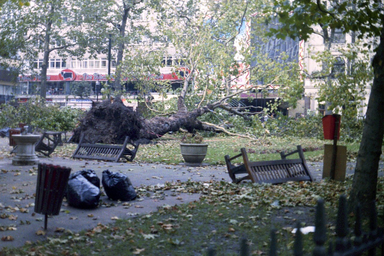
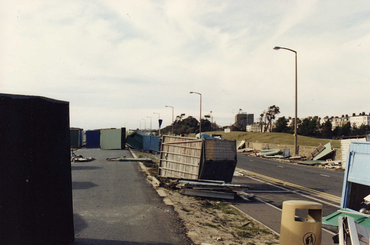
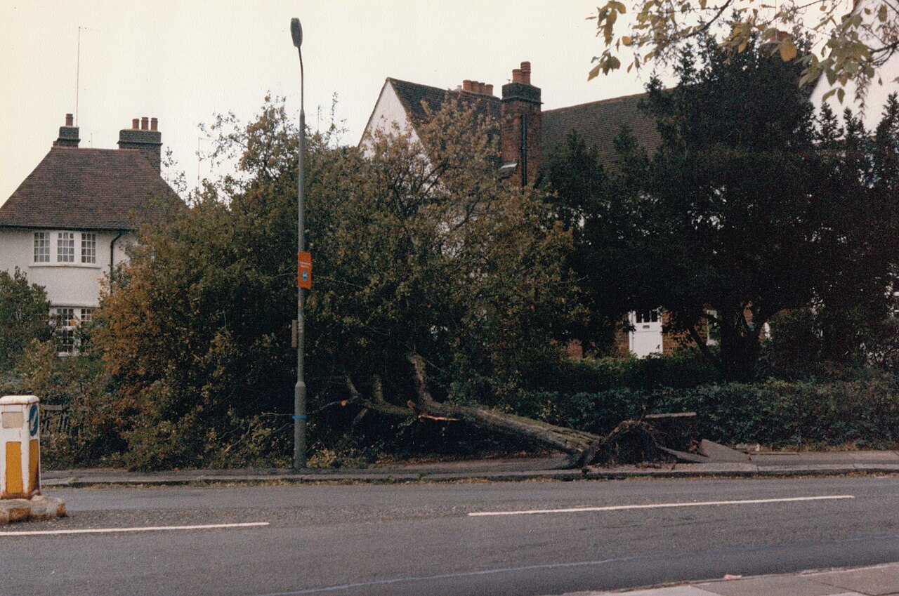
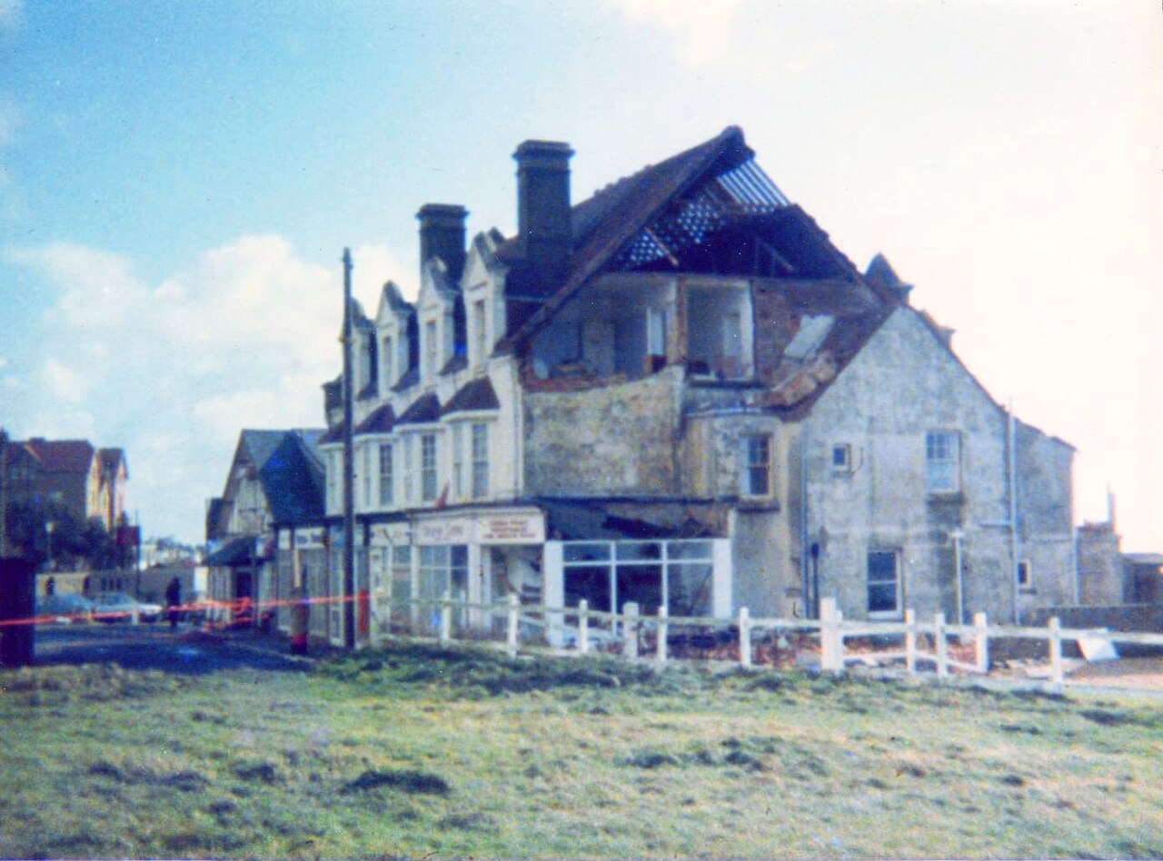
Photos: Carl Grove, Leonora (Ellie) Enking and David Howard (CC BY-SA 2.0); Pasicles (CC0 1.0), via Wikimedia Commons.
Leicester Square. File title: Leicester Square - geograph.org.uk - 3435454.jpg. Photo: Carl Grove. Licence: CC BY-SA 2.0. Held at Wikimedia Commons: https://commons.wikimedia.org/
Littlehampton seafront. File title: Littlehampton seafront (6402378031).jpg. Photo: Leonora (Ellie) Enking. Licence: CC BY-SA 2.0. Held at Wikimedia Commons: https://commons.wikimedia.org/
Erskine Hill. File title: Casualty of the 1987 storm, Erskine Hill - geograph.org.uk - 3827863.jpg. Photo: David Howard. Licence: CC BY-SA 2.0. Held at Wikimedia Commons: https://commons.wikimedia.org/
Barton on Sea. File title: Storm damaged building - Barton on Sea - October 1987.jpg. Photo: Pasicles. Licence: CC0 1.0. Held at Wikimedia Commons: https://commons.wikimedia.org/
Where the licences are published: Creative Commons Attribution-ShareAlike 2.0 (CC BY-SA 2.0): https://creativecommons.org/
Each picture is shown smaller and cropped to fit its frame; nothing else about it is changed. The date and place of each photo are from its own record at Wikimedia Commons.
An uprooted tree and overturned benches in Leicester Square, London. 19 October 1987.
Photo: Carl Grove, CC BY-SA 2.0
Beach huts blown over along the seafront at Littlehampton, West Sussex. 17 October 1987.
Photo: Leonora (Ellie) Enking, CC BY-SA 2.0
A street tree torn out by its roots on Erskine Hill, Hampstead Garden Suburb, London. 16 October 1987.
Photo: David Howard, CC BY-SA 2.0
A sea-front building with its roof torn open at Barton on Sea, Hampshire. About 18 October 1987.
Photo: Pasicles, CC0 1.0
FloodRadar compiles Environment Agency warning history, gauge data and public reporting. It is not an emergency service and does not replace official flood warnings — always follow official guidance during a storm.
FloodRadar helper · beta