 FloodRadar
Log inCreate free account
FloodRadar
Log inCreate free account
25–26 January 1990 · named by historic · England, Wales, Scotland
Did this storm flood you? Log it
| Gauge | Total mm |
|---|---|
| Waen Sychlwch · Dyfed · Met Office | 124.4 |
| Cray Resr No 2 · Powys South · Met Office · includes 2 estimated days | 116.5 |
| Llyn Fawr Resr No 1 · Mid Glamorgan · Met Office · includes 4 estimated days | 107.3 |
| Greenhills Farm · Durham · Met Office | 101.9 |
| Llyn Eigiau · Gwynedd · Met Office · includes 4 estimated days | 100.7 |
| Cononish No 2 · Perthshire in Central Region · Met Office | 100.7 |
| Swincombe · Devon · Met Office · includes 2 estimated days | 99.4 |
| Llanymawddwy, Troed-Y-Fo · Gwynedd · Met Office | 99.4 |
| Nantyrwydd · Powys South · Met Office | 98.2 |
| Aberangell, Esgairangell · Gwynedd · Met Office | 97.5 |
| Cowlyd · Gwynedd · Met Office · includes 4 estimated days | 96.0 |
| Moel Cynnedd · Powys North · Met Office | 95.1 |
Met Office gauges: days from 09:00 to 09:00, the same dates.
Met Office (2026): MIDAS Open: UK daily rainfall data, v202607. NERC EDS Centre for Environmental Data Analysis. Open Government Licence v3.
| Station | Peak | % of warning |
|---|---|---|
| Shipley · Bradford Beck · Above typical high | 1.09 m | 274% |
| Skipton Eller Beck · Eller Beck · Above typical high | 2.01 m | 269% |
| Ilam · River Manifold · Above typical high | 1.23 m | 235% |
| Leasingham Mill · River Slea · Above typical high | 1.11 m | 222% |
| Harwood · Harwood Beck · Very high | 1.26 m | 219% |
| Calthorpe Park · River Rea · Above typical high | 0.86 m | 206% |
| Rowlands Gill · River Derwent · Above typical high | 0.65 m | 204% |
| Rocester · River Dove · Above typical high | 1.28 m | 191% |
| Little Bowden · River Jordan · Above typical high | 1.38 m | 182% |
| Llanyblodwel · River Tanat · High for this river | 1.87 m | 178% |
| Ashford in the Water · River Wye · Above typical high | 1.29 m | 172% |
| Offenham · Badsey Brook · Above typical high | 1.85 m | 166% |
Gauge records cover 24–27 January 1990 (the storm window ± a day). Frozen 17 Oct 2026.
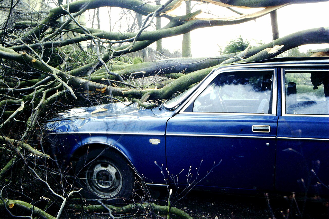
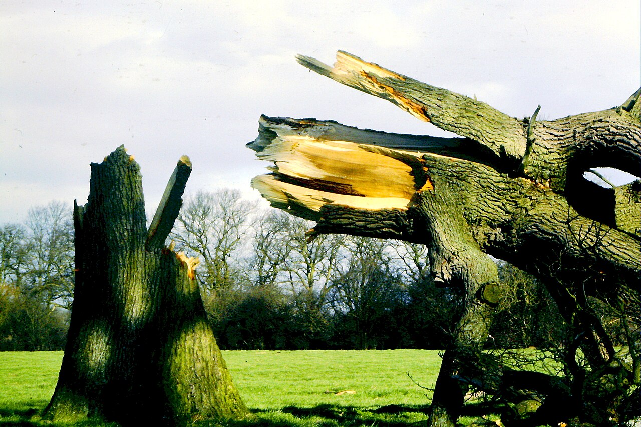
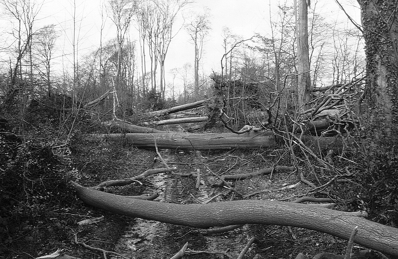
Photos: Ray Bird (CC BY-SA 2.0), via Wikimedia Commons.
Badminton. File title: Gale force storm wind damage, Badminton, Gloucestershire 1990 - geograph.org.uk - 6249499.jpg. Photo: Ray Bird. Licence: CC BY-SA 2.0. Held at Wikimedia Commons: https://commons.wikimedia.org/
Near Westonbirt. File title: Gale force storm wind damage, nr Westonbirt, Gloucestershire 1990 - geograph.org.uk - 6249539.jpg. Photo: Ray Bird. Licence: CC BY-SA 2.0. Held at Wikimedia Commons: https://commons.wikimedia.org/
Severn Mile Plantation. File title: Gale force storm wind damage, Badminton, Gloucestershire 1990 - geograph.org.uk - 6249512.jpg. Photo: Ray Bird. Licence: CC BY-SA 2.0. Held at Wikimedia Commons: https://commons.wikimedia.org/
Where the licences are published: Creative Commons Attribution-ShareAlike 2.0 (CC BY-SA 2.0): https://creativecommons.org/
Each picture is shown smaller and cropped to fit its frame; nothing else about it is changed. The date and place of each photo are from its own record at Wikimedia Commons.
A fallen tree across a car at Badminton, South Gloucestershire, after the storm-force gales. About 25 January 1990.
Photo: Ray Bird, CC BY-SA 2.0
A large oak snapped by the gales near Westonbirt, Gloucestershire. About 25 January 1990.
Photo: Ray Bird, CC BY-SA 2.0
Trees blown down across a ride in Severn Mile Plantation, near Badminton, South Gloucestershire. About 25 January 1990.
Photo: Ray Bird, CC BY-SA 2.0
FloodRadar compiles Environment Agency warning history, gauge data and public reporting. It is not an emergency service and does not replace official flood warnings — always follow official guidance during a storm.
FloodRadar helper · beta