Eden and Esk catchment
• Carlisle • Cumberland • ID: 765512 • Level
(30m ago) • 4 readings/hr • 176 views
Set water level alerts
Get notified about Sheepmount — tick as many as you like, they all share the notify settings below.
Alert me when (tick one or more)
⤴Unusual rise — FloodRadar+Top 1% rise rate for this gauge.
Height for "Above a height"
Drag the line on the chart, or type a value:m
Quick pick:
You'll be notified when this gauge is rising more than 0.10 m/hr — a sign of rapidly increasing water levels.
You'll be notified when a new storm-overflow (sewage) discharge starts within ~3 km of this gauge, based on the water companies' near-real-time feeds.
Notify by (tick one or more)
Your browser will ask permission, then you'll get a notification even when FloodRadar isn't open.
On iPhone: tap Share → Add to Home Screen first, then open it from there and set the alert. Show me how
Each one is saved as its own alert — pause or remove them individually any time.
Not an emergency service — if in danger call 999. Alerts rely on
EA/SEPA/NRW data and are best-efforts. Terms
Current Level
1.390 m
▲ Rising (+4cm/hr)
24h Max
1.390 m
24h Min
0.809 m
Typical Range
0.63 - 3.45
m
Highest Recorded
7.65 m
EA official record
7.65 in our data (since Dec 1975)
Current level is 18% of this
🚽Sewage overflows nearby
Recent Water Levels
🌍 floodradar.co.uk
1 day
EA forecast (official)
Prediction V2
Prediction Eris
Nimbus beta
Experimental model fusing soil moisture, river flow, groundwater and catchment
character. The shaded band is its 10–90% range, widened so that about 80% of recent outcomes fall inside it.
Under evaluation — not yet promoted, so treat as a second opinion.
River Flow
90 days
Daily mean discharge (m³/s) with the daily min–max band, from the EA Hydrology API. Flow is the volume of water passing the gauge — often a more direct flood signal than level.
Flow Data: Daily mean flow (m³/s) to 7 Oct (2 days behind — the EA publishes each day's mean a day or two after it ends; unchecked, provisional)via EA Hydrology
Storm overflows whose water reaches this gauge on the mapped river network, nearest first by distance along the river. The status is each water company's monitor: it says whether an overflow is discharging, not how much or what it contains.
101 storm overflows are traced upstream of this gauge, the nearest 710 m away along the river. 0 report discharging now, 97 report not discharging, and for 4 the monitor is offline or has not reported, so their status is not known.
United Utilities · into River Eden Estuary · 5.1 km away in a straight line · discharges to the sea, an estuary or tidal water
80 spills · 578 hours in 2025
Not discharging now · last
6 other overflows within 6 km are downstream of this gauge or on another branch of the river network, so they are not listed.
These are the water companies' monitor statuses; a spill does not by itself explain a change in the gauge level. River connections and distances are traced on OS Open Rivers (edition 2026-04), which leaves out many small channels. Explore the sewage map →
Warnings apply to a whole flood area, not necessarily this exact spot. Years before 2006 aren't covered by the EA's historic record.
See also the Carlisle flood history.
Flood areas linked to this gauge
Flood warnings and alerts are issued for whole areas. These are the 22 areas linked to this gauge, nearest first.
🌊 Fairly flashyResponds fairly quickly to rain, with moderate baseflow between events.
Your catchment is all the land that drains rainfall into the river above this gauge. Its character — how
steep, wet, wooded, urban or chalky that land is — decides how fast rain here turns into a rising river. A steep, bare or clay
catchment is “flashy” (rises and falls quickly, floods easily); a flat, chalk or well-wooded one is
slow and steady. The tiles below put numbers to that; the flow-duration curve reads left-to-right
from the river’s typical high flows (Q5) down to its low flows (Q95) — a steep curve means a flashy river.
The physical character of the land that drains to this gauge, and how it shapes its flood response — from the National River Flow Archive (UKCEH).
Baseflow Index
0.49
mixed response
Avg Annual Rainfall
1,316 mm/yr
1991–2020 · +8% since 1941–70
Urban Extent
0.8%
largely rural
Median Annual Flood
646 m³/s
QMED — typical yearly peak flow
Highest Daily Mean Flow
1,167 m³/s
6 Dec 2015 · daily mean, not the instantaneous peak
Flow-Duration Curve
Daily flow (m³/s) exceeded each % of the time — a steep curve is flashy, a flat one is steady. Q5 high · Q50 median · Q95 low.
Velocity area station, the furthest downstream on the River Eden.
More detail
The catchment
Rural catchment except for Carlisle, Penrith and Appleby. Headwaters in Carboniferous Limestone of Pennines to east, impervious Lower Palaeozoics of Lake District massif to west; moorland. Extensive Boulder Clay covered Permo-Triassic sandstone in Vale of Eden. Land-use: arable and grazing. No significant catchment changes.
The station
Velocity area station opened 1967 in a deep, slack section. River approximately 35m wide at gauging section.
How it measures flow
Permanent cableway. Full-range. Most floods contained in immediate channel, significant bypassing on left bank, more so before 1970, when floodbanks constructed. However, post-1970 major floods, such as Storm Desmond still have very significant bypassing and floodplain flow. Inlet may block at high flows - extended c2013. Gravel movement around downstream bridge and weed growth may affect low flows. Periodic recalibration. Multiple ratings consolidated pre-1993 to remove extrapolation of the effects of weed growth and gravel movement into the peak flow range. Two peak flow ratings therefore applied across period of record derived from current meter gaugings, the most recent is applied after storm Desmond.
Flow regime
Mainly natural catchment, but contains some large settlements (Carlisle, Penrith) and reservoirs (Haweswater, Wet Sleddale). Reservoirs control 2% of catchment naturally, though actual proportion may be higher as Haweswater collects water from Lowther tributaries. Flows influenced by these, especially at low flows.
The flow record
A new rating from December 2015 (storm Desmond) onwards was implemented in January 2019. However, peak flows are thought to be underestimated by 5 - 15% and a further rating review is in progress. Full period of record peak flow data reviewed and released in August 2024 (WINFAP Files v13).
Timing, not cause. Gauges can move together simply because the same rain fell on both.
Frequently asked questions
Is the River Eden at Sheepmount flooding today?
The current level is 1.39m, which is within the typical range of 0.63 to 3.45m. Flooding is unlikely at this level.
Is the river level rising or falling at Sheepmount?
Based on the most recent readings, the level is currently rising. The chart above shows the last 12 hours of measurements by default (up to 7 days), updated roughly every 15 minutes.
What is a normal level for the River Eden at Sheepmount?
The typical range at this station is 0.63m to 3.45m, based on Environment Agency historical data. Levels above 3.45m are higher than usually seen and may indicate a flood risk.
How often is this river level data updated?
Readings are supplied by the Environment Agency gauge. FloodRadar checks for updates roughly every 15 minutes; the timestamp above shows how recent the latest available reading is.
Embed this gauge on your website
Free live river-level widget — ideal for parish councils, angling clubs and local sites. Updates automatically.
Preview
📮 Flood risk by postcode near this gauge
Postcodes within 5 km with properties in the Environment Agency’s rivers-and-sea flood-risk bands:
 FloodRadar
Log inCreate free account
FloodRadar
Log inCreate free account
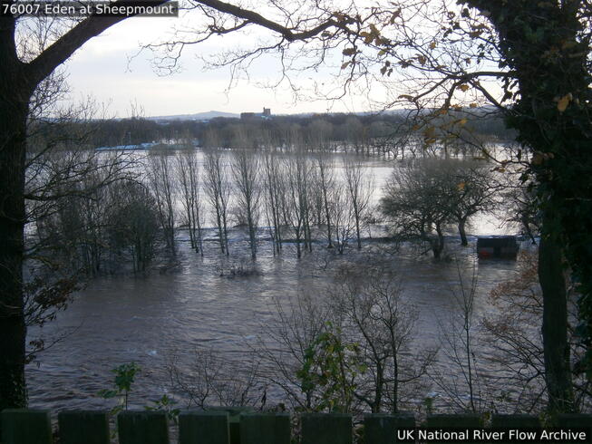 7 Dec 2015 Floodplain bypass flow during Storm Desmond looking from right bank.
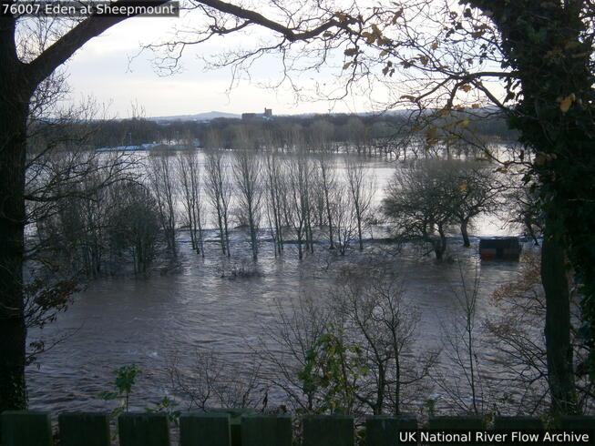 7 Dec 2015 Flooding during storm Desmond
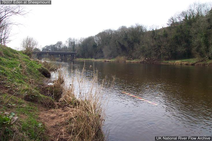 30 Mar 2004 Looking downstream
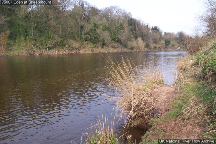 30 Mar 2004 Looking upstream
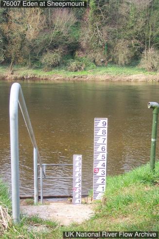 30 Mar 2004 Gauge boards on the bank below the gauging station
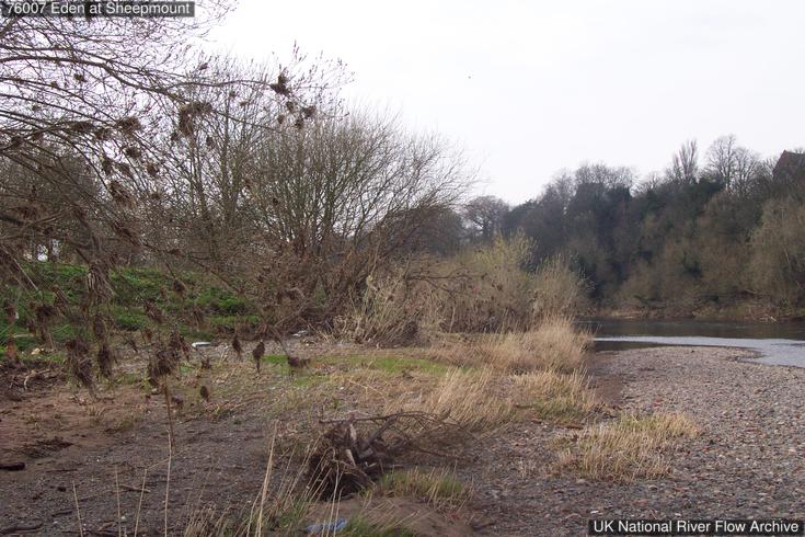 30 Mar 2004 Wrack by the rivers edge
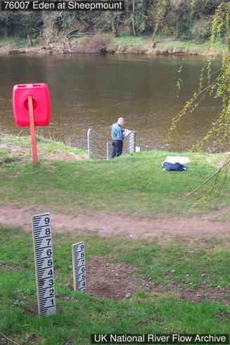 30 Mar 2004 Gauge boards on the bank below the gauging station
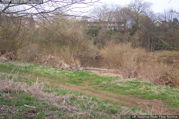 30 Mar 2004 Recently distressed vegetation above the path on the left bank
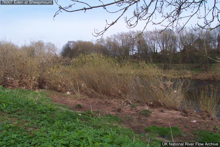 30 Mar 2004 Recently distressed vegetation on the left bank
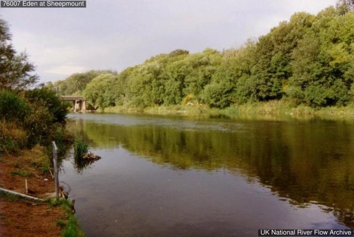 Looking downstream from station
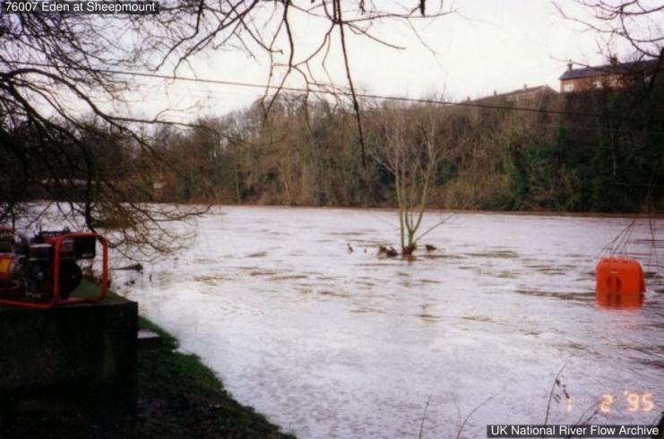 River in flood