Aire and Calder catchment
• Whitwood • West Yorkshire • ID: F1301 • Level
(27m ago) • 4 readings/hr • 180 views
Set water level alerts
Get notified about Methley — tick as many as you like, they all share the notify settings below.
Alert me when (tick one or more)
⤴Unusual rise — FloodRadar+Top 1% rise rate for this gauge.
Height for "Above a height"
Drag the line on the chart, or type a value:m
Quick pick:
You'll be notified when this gauge is rising more than 0.10 m/hr — a sign of rapidly increasing water levels.
You'll be notified when a new storm-overflow (sewage) discharge starts within ~3 km of this gauge, based on the water companies' near-real-time feeds.
Notify by (tick one or more)
Your browser will ask permission, then you'll get a notification even when FloodRadar isn't open.
On iPhone: tap Share → Add to Home Screen first, then open it from there and set the alert. Show me how
Each one is saved as its own alert — pause or remove them individually any time.
Not an emergency service — if in danger call 999. Alerts rely on
EA/SEPA/NRW data and are best-efforts. Terms
Current Level
1.345 m
▼ Easing (+1cm/hr)
24h Max
1.428 m
24h Min
1.194 m
Typical Range
1.10 - 3.10
m
Highest Recorded
3.69 m
EA official record
3.68 in our data (since Jul 1961)
Current level is 36% of this
🚽Sewage overflows nearby
Recent Water Levels
🌍 floodradar.co.uk
1 day
EA forecast (official)
Prediction V2
Prediction Eris
Nimbus beta
Experimental model fusing soil moisture, river flow, groundwater and catchment
character. The shaded band is its 10–90% range, widened so that about 80% of recent outcomes fall inside it.
Under evaluation — not yet promoted, so treat as a second opinion.
River Flow
90 days
Daily mean discharge (m³/s) with the daily min–max band, from the EA Hydrology API. Flow is the volume of water passing the gauge — often a more direct flood signal than level.
Flow Data: Daily mean flow (m³/s) to 8 Oct (2 days behind — the EA publishes each day's mean a day or two after it ends; unchecked, provisional)via EA Hydrology
Storm overflows whose water reaches this gauge on the mapped river network, nearest first by distance along the river. The status is each water company's monitor: it says whether an overflow is discharging, not how much or what it contains.
287 storm overflows are traced upstream of this gauge, the nearest 1.5 km away along the river. 1 reports discharging now, 278 report not discharging, and for 8 the monitor is offline or has not reported, so their status is not known.
Yorkshire Water · into Hollins Beck · 4.1 km away in a straight line · no mapped watercourse close enough to be sure
3 spills · 19 hours in 2025
Not discharging now · last
6 more within 6 km whose connection is not known.
16 other overflows within 6 km are downstream of this gauge or on another branch of the river network, so they are not listed.
These are the water companies' monitor statuses; a spill does not by itself explain a change in the gauge level. River connections and distances are traced on OS Open Rivers (edition 2026-04), which leaves out many small channels. Explore the sewage map →
Warnings apply to a whole flood area, not necessarily this exact spot. Years before 2006 aren't covered by the EA's historic record.
See also the Whitwood flood history.
Flood areas linked to this gauge
Flood warnings and alerts are issued for whole areas. These are the 11 areas linked to this gauge, nearest first.
🌊 Mixed responseA balance of quick runoff and slower groundwater baseflow.
Your catchment is all the land that drains rainfall into the river above this gauge. Its character — how
steep, wet, wooded, urban or chalky that land is — decides how fast rain here turns into a rising river. A steep, bare or clay
catchment is “flashy” (rises and falls quickly, floods easily); a flat, chalk or well-wooded one is
slow and steady. The tiles below put numbers to that; the flow-duration curve reads left-to-right
from the river’s typical high flows (Q5) down to its low flows (Q95) — a steep curve means a flashy river.
The physical character of the land that drains to this gauge, and how it shapes its flood response — from the National River Flow Archive (UKCEH).
Baseflow Index
0.53
mixed response
Avg Annual Rainfall
1,062 mm/yr
1991–2020 · +4% since 1941–70
Urban Extent
11%
partly urbanised
Median Annual Flood
240 m³/s
QMED — typical yearly peak flow
Highest Daily Mean Flow
306 m³/s
21 Jan 2008 · daily mean, not the instantaneous peak
Flow-Duration Curve
Daily flow (m³/s) exceeded each % of the time — a steep curve is flashy, a flat one is steady. Q5 high · Q50 median · Q95 low.
Sidelooker that replaced a multi-path ultrasonic station opened in 1986, replacing 27004. Catchment is heavily reservoired and affected by complex water transfers.
More detail
The catchment
Catchment draining the eastern flank of the Pennines. The impermeable geology is predominantly Upper Carboniferous Millstone Grit. Headwaters rise from rough-grazed, peat-covered moorland. Very steep, often-wooded headwater valleys cut down through Millstone Grit. The valley floors are strongly urbanised and industrialised. Significant urbanisation throughout period of record. Coal mining activity in the lower reaches but this has subsequently declined in recent years. Flood relief channel built at Dewsbury.
The station
Sidelooker since Nov 2021. Previously, multi-path ultrasonic gauging station positioned on a long straight reach around 45m wide, between flood banks. Primary gauging station on the River Calder, measures full range of flow. Constructed in 1986 but ultrasonic gauge records only available from June 1988, replaced earlier station at Newlands (27004) which closed in 1975.
How it measures flow
Multi-path ultrasonic gauge in 45m wide section with raised embankments to 4m stage, no known by-passing. No formal control and variable backwater from confluence with Aire 1.8km downstream. Very low velocities at low flow affecting check gauging accuracy, also thermal stratification affecting ultrasonic gauge in summer. Regular pulsing in velocity observed at low flows, possibly due to boat movements. High suspended solids and long path lengths can cause signal attenuation at high flow, a number of periods infilled from back up rating. Various gauging locations over period of record, originally at cableway at Newlands, subsequently from road bridge d/s of gauge and recently by ArcBoat in gauge section. Some variability in gaugings due to lack of formal control but rating is considered reasonable to use as back up for data infilling when required. Gauged to 70% of AMAX1. Gauge may have been affected by mining subsidence during the period of operation.
Flow regime
Heavy influence of reservoirs, estimated 9.3% of catchment area drains through 21 impoundments. Complicated water transfer plan and significant effluent returns. Sluice/weir systems on the River Aire may influence levels at Methley.
The flow record
Full period of record peak flow data reviewed and released in September 2022 (WINFAP Files v11).
Timing, not cause. Gauges can move together simply because the same rain fell on both.
Frequently asked questions
Is the River Calder at Methley flooding today?
The current level is 1.35m, which is within the typical range of 1.10 to 3.10m. Flooding is unlikely at this level.
Is the river level rising or falling at Methley?
Based on the most recent readings, the level is currently falling slightly. The chart above shows the last 12 hours of measurements by default (up to 7 days), updated roughly every 15 minutes.
Why is the level slowly falling?
When little or no rain has fallen for a while, a river level gradually drops as the water stored in the ground and soil drains away with nothing to replace it. This is called baseflow recession and is normal in dry spells. A gentle decline like this is expected and is not a sign of a problem — downstream gauges often recede a little faster than headwaters further upstream, and levels recover once rain returns.
What is a normal level for the River Calder at Methley?
The typical range at this station is 1.10m to 3.10m, based on Environment Agency historical data. Levels above 3.10m are higher than usually seen and may indicate a flood risk.
How often is this river level data updated?
Readings are supplied by the Environment Agency gauge. FloodRadar checks for updates roughly every 15 minutes; the timestamp above shows how recent the latest available reading is.
Embed this gauge on your website
Free live river-level widget — ideal for parish councils, angling clubs and local sites. Updates automatically.
Preview
📮 Flood risk by postcode near this gauge
Postcodes within 5 km with properties in the Environment Agency’s rivers-and-sea flood-risk bands:
 FloodRadar
Log inCreate free account
FloodRadar
Log inCreate free account
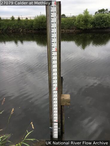 22 Jul 2020 Gauge board
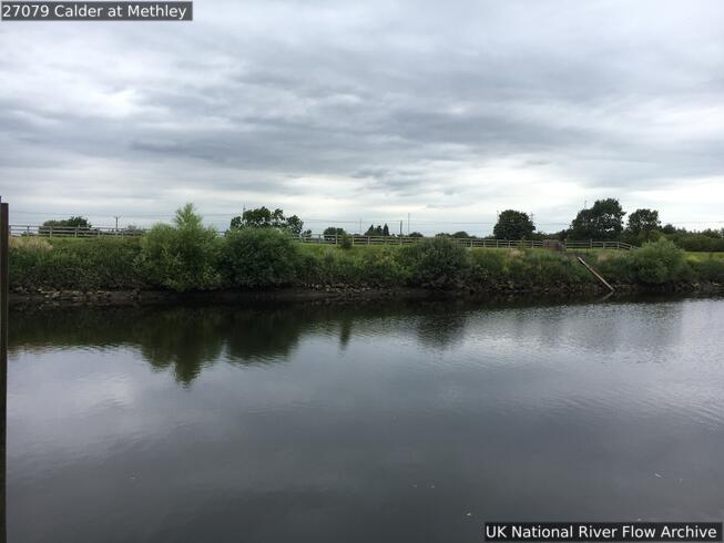 22 Jul 2020 View downstream from the right bank
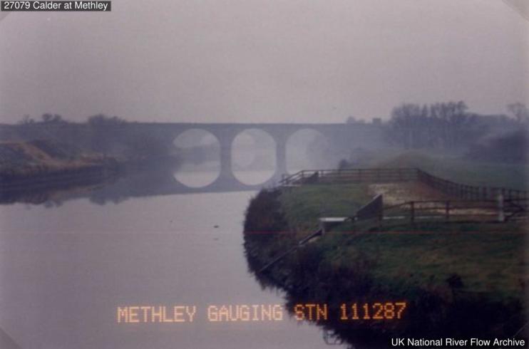 11 Dec 1987 Looking upstream
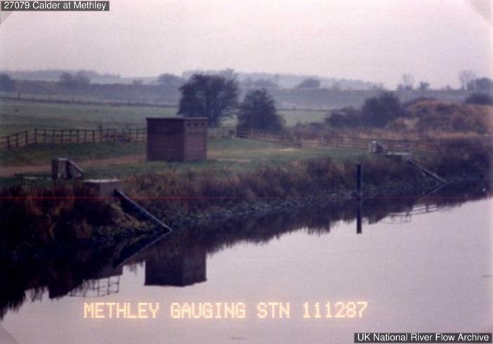 11 Dec 1987 Looking upstream from right bank