None of the storm overflows FloodRadar holds is traced upstream of this gauge on the mapped river network. That is not the same as none: the map leaves out many small streams and culverts, so an overflow it cannot place may still drain here, and not every company publishes every overflow. Those nearby are listed below.
Nearby, connection not known
Within 6 km in a straight line, but the river map cannot say whether their water passes this gauge.
Wessex Water · into River Avill (S) · 4.2 km away in a straight line · no mapped watercourse close enough to be sure
9 spills · 20 hours in 2025
Not discharging now · last
These are the water companies' monitor statuses; a spill does not by itself explain a change in the gauge level. River connections and distances are traced on OS Open Rivers (edition 2026-04), which leaves out many small channels. Explore the sewage map →
🌊 Mixed responseA balance of quick runoff and slower groundwater baseflow.
Your catchment is all the land that drains rainfall into the river above this gauge. Its character — how
steep, wet, wooded, urban or chalky that land is — decides how fast rain here turns into a rising river. A steep, bare or clay
catchment is “flashy” (rises and falls quickly, floods easily); a flat, chalk or well-wooded one is
slow and steady. The tiles below put numbers to that; the flow-duration curve reads left-to-right
from the river’s typical high flows (Q5) down to its low flows (Q95) — a steep curve means a flashy river.
The physical character of the land that drains to this gauge, and how it shapes its flood response — from the National River Flow Archive (UKCEH).
Baseflow Index
0.64
mixed response
Avg Annual Rainfall
1,025 mm/yr
1991–2020 · +1% since 1941–70
Urban Extent
5.5%
partly urbanised
Median Annual Flood
13.52 m³/s
QMED — typical yearly peak flow
Highest Daily Mean Flow
15.80 m³/s
12 Jan 2023 · daily mean, not the instantaneous peak
Flow-Duration Curve
Daily flow (m³/s) exceeded each % of the time — a steep curve is flashy, a flat one is steady. Q5 high · Q50 median · Q95 low.
Land Cover (2023)
Woodland 7%Grassland 49%Arable 31%Urban 13%
Grassland 60% → 49% since 1990
Photos
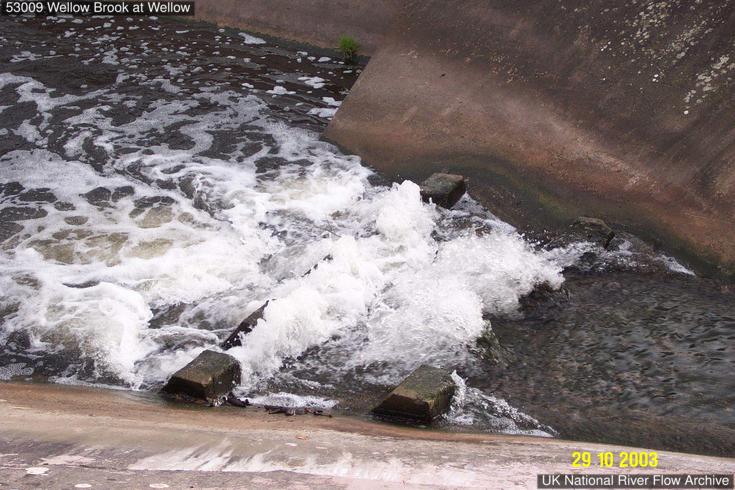
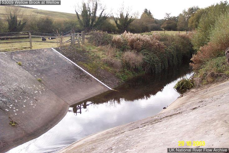
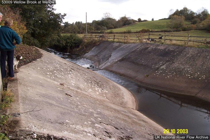
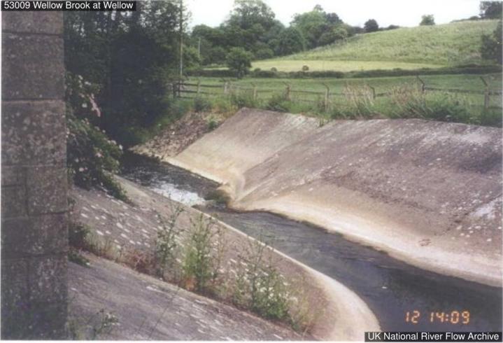
Gauging-station photographs from the National River Flow Archive (UKCEH).
The catchment area upstream of the gauging station is characterised as predominantly rural but with urban centres at Midsomer Norton and Radstock. The watercourse lies on a thin band of the Trias and Lias that overlays the coal measures of the Somerset coal field and the catchment is dominated by geology of Lias and Oolitic Limestone. Very steep-sided valleys and rapid rainfall response. No major catchment changes.
The station
Station opened in 1966. Trapezoidal critical depth flume on incised channel. Two bridges approx. 50 m downstream. Bed-mounted hydro-acoustic gauge installed 07/2007. As of 2019, station in need of significant maintenance, concrete is spalling. Gaugings are consistently positive, d/s blocks maybe affecting flows.
How it measures flow
Full range station. Slight bypassing on right-hand bank. The river bed is composed of river alluvium and gravel and is lined with trees and vegetation. Algal growth affects sensitivity at low flows. Unadjusted step-changes in summer months due to weir cleaning and weed management are evident throughout the record. Mean Annual Flood adequately gauged; 100-year flow estimate within modular limit of the flume. Theoretical rating applied across whole period of record.
Flow regime
Natural to within 10% at Q95.
The flow record
Backing up from bridge downstream occurred during 07/1968 flood (flow ~30 cumecs). Full period of record peak flow data reviewed and released in September 2022 (WINFAP Files v11).
How this gauging station is built and how long it has measured (NRFA / UKCEH).
Gauge type
Flume
Operating since
1966
Station datum
43.7 mAOD
Flow record
1966–2024 · 58 yrs · 100% complete
Peak-flow record
since 1966
Hydrometric area
53
Measured by
Environment Agency
Nearby Groundwater
Soil Moisture
Frequently asked questions
Is WEST LUCCOMBE flooding today?
The latest recorded level is 0.09m. Compare it with the recent history on the chart above to judge whether levels are unusually high.
Is the river level rising or falling at WEST LUCCOMBE?
Based on the most recent readings, the level is currently steady. The chart above shows the last 12 hours of measurements by default (up to 7 days), updated roughly every 15 minutes.
How often is this river level data updated?
Readings are supplied by the Environment Agency gauge. FloodRadar checks for updates roughly every 15 minutes; the timestamp above shows how recent the latest available reading is.
Embed this gauge on your website
Free live river-level widget — ideal for parish councils, angling clubs and local sites. Updates automatically.
Preview
📮 Flood risk by postcode near this gauge
Postcodes within 5 km with properties in the Environment Agency’s rivers-and-sea flood-risk bands:
 FloodRadar
Log inCreate free account
FloodRadar
Log inCreate free account