Get notified about Bealsmill — tick as many as you like, they all share the notify settings below.
Alert me when (tick one or more)
⤴Unusual rise — FloodRadar+Top 1% rise rate for this gauge.
Height for "Above a height"
Drag the line on the chart, or type a value:m
Quick pick:
You'll be notified when this gauge is rising more than 0.10 m/hr — a sign of rapidly increasing water levels.
You'll be notified when a storm overflow starts discharging, from the water companies' near-real-time feeds. Which overflows:
Get notified when recent rainfall near this gauge crosses its learnt rise trigger — an early "watch"
signal, typically hours before a rise. Experimental; not an official flood warning.
Notify by (tick one or more)
Your browser will ask permission, then you'll get a notification even when FloodRadar isn't open.
On iPhone: tap Share → Add to Home Screen first, then open it from there and set the alert. Show me how
Each one is saved as its own alert — pause or remove them individually any time.
Not an emergency service — if in danger call 999. Alerts rely on
EA/SEPA/NRW data and are best-efforts. Terms
Flooding is possible for Rame Peninsula, Callington, Saltash, Rilla Mill, Pillaton, and Landrake.
High river levels today may lead to flooding.
Flooding is possible on Sunday 22 November.
The following gauge is forecast to reach Flood Alert criteria: Pillaton.
River levels have risen in response to overnight rainfall. River levels will continue to rise through Sunday and will remain high into next week with further heavy and prolonged rain forecast for Monday and Tuesday. Surface water flooding impacts are possible.
Locations most affected will be low lying land and roads near rivers.
We are closely monitoring the situation.
Take care and avoid walking, cycling, or driving through flood water.
This message will be updated by 11:00AM on Monday 23 November or sooner if the situation changes.
Experimental model fusing soil moisture, river flow, groundwater and catchment
character. The shaded band is its 10–90% range, widened so that about 80% of recent outcomes fall inside it.
Under evaluation — not yet promoted, so treat as a second opinion.
River Flow
90 days
Daily mean discharge (m³/s) with the daily min–max band, from the EA Hydrology API. Flow is the volume of water passing the gauge — often a more direct flood signal than level.
Flow Data: Daily mean flow (m³/s) to 19 Nov (3 days behind — the EA publishes each day's mean a day or two after it ends; unchecked, provisional)via EA Hydrology
Storm overflows whose water reaches this gauge on the mapped river network, nearest first by distance along the river. The status is each water company's monitor: it says whether an overflow is discharging, not how much or what it contains.
4 storm overflows are traced upstream of this gauge, the nearest 4.2 km away along the river. 3 report discharging now, 1 reports not discharging.
South West Water · into Trib Of River Tamar · 5.4 km away in a straight line · its watercourse is not on the river map
12 spills · 26 hours in 2025
Not discharging now · last
6 other overflows within 6 km are downstream of this gauge or on another branch of the river network, so they are not listed.
These are the water companies' monitor statuses; a spill does not by itself explain a change in the gauge level. River connections and distances are traced on OS Open Rivers (edition 2026-10), which leaves out many small channels. Sewage & storm overflows →
Warnings apply to a whole flood area, not necessarily this exact spot. Years before 2006 aren't covered by the EA's historic record.
See also the Bealsmill flood history.
Flood areas linked to this gauge
Flood warnings and alerts are issued for whole areas. These are the 7 areas linked to this gauge, nearest first.
🌊 Mixed responseA balance of quick runoff and slower groundwater baseflow.
Your catchment is all the land that drains rainfall into the river above this gauge. Its character — how
steep, wet, wooded, urban or chalky that land is — decides how fast rain here turns into a rising river. A steep, bare or clay
catchment is “flashy” (rises and falls quickly, floods easily); a flat, chalk or well-wooded one is
slow and steady. The tiles below put numbers to that; the flow-duration curve reads left-to-right
from the river’s typical high flows (Q5) down to its low flows (Q95) — a steep curve means a flashy river.
The physical character of the land that drains to this gauge, and how it shapes its flood response — from the National River Flow Archive (UKCEH).
Baseflow Index
0.58
mixed response
Avg Annual Rainfall
1,498 mm/yr
1991–2020 · +8% since 1941–70
Urban Extent
0.4%
largely rural
Median Annual Flood
33.94 m³/s
QMED — typical yearly peak flow
Highest Daily Mean Flow
44.82 m³/s
27 Dec 1979 · daily mean, not the instantaneous peak
Flow-Duration Curve
Daily flow (m³/s) exceeded each % of the time — a steep curve is flashy, a flat one is steady. Q5 high · Q50 median · Q95 low.
Land Cover (2023)
Woodland 6%Grassland 84%Arable 8%Urban 2%Other 1%
Photos
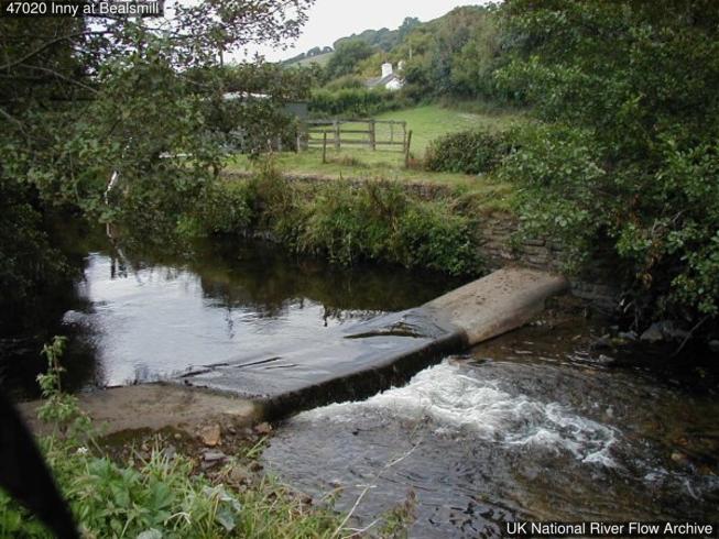
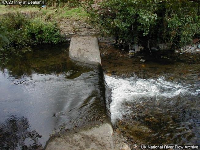
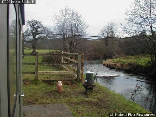
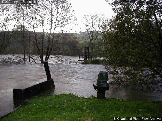
Gauging-station photographs from the National River Flow Archive (UKCEH).
Broad crested weir built in 1988 to replace previous velocity area station.
More detail
The catchment
Mixed geology, mostly Upper Devonian, Culm Measures, Carboniferous with some areas of slate and thin limestone. Land-use: rural, low intensity agriculture, beef/sheep and dairy farms in lower reaches. No major urbanisation in the catchment. No major catchment changes.
The station
Velocity area station with a low flow bed control built in 1976. Station re-opened with broad-crested weir in 1988. Channel approximately 9.5m wide.
How it measures flow
Bankfull at 1.8m. Station subject to mobile bed/shoaling downstream of weir so rating prone to shifting. Gaugings taken to allow preparation of ratings to account for this. Multiple peak flow ratings applied across period of record. Rating derived from current meter gaugings from cableway.
Flow regime
No major artificial influences.
The flow record
Station closed 01/01/1981 - 11/10/1988; no data available. Downstream siltation led to the drowning of the control structure during high flows in 12/1999. Full period of record peak flow data reviewed and released in October 2018 (WINFAP Files v7).
Timing, not cause. Gauges can move together simply because the same rain fell on both.
Frequently asked questions
Is the River Inny at Bealsmill flooding today?
The current level is 1.54m, which is within the typical range of 0.29 to 1.80m. Flooding is unlikely at this level.
Is the river level rising or falling at Bealsmill?
Based on the most recent readings, the level is currently rising. The chart above shows the last 12 hours of measurements by default (up to 7 days), updated roughly every 15 minutes.
What is a normal level for the River Inny at Bealsmill?
The typical range at this station is 0.29m to 1.80m, based on Environment Agency historical data. Levels above 1.80m are higher than usually seen and may indicate a flood risk.
How often is this river level data updated?
Readings are supplied by the Environment Agency gauge. FloodRadar checks for updates roughly every 15 minutes; the timestamp above shows how recent the latest available reading is.
Embed this gauge on your website
Free live river-level widget — ideal for parish councils, angling clubs and local sites. Updates automatically.
Preview
📮 Flood risk by postcode near this gauge
Postcodes within 5 km with properties in the Environment Agency’s rivers-and-sea flood-risk bands:
 FloodRadar
Log inCreate free account