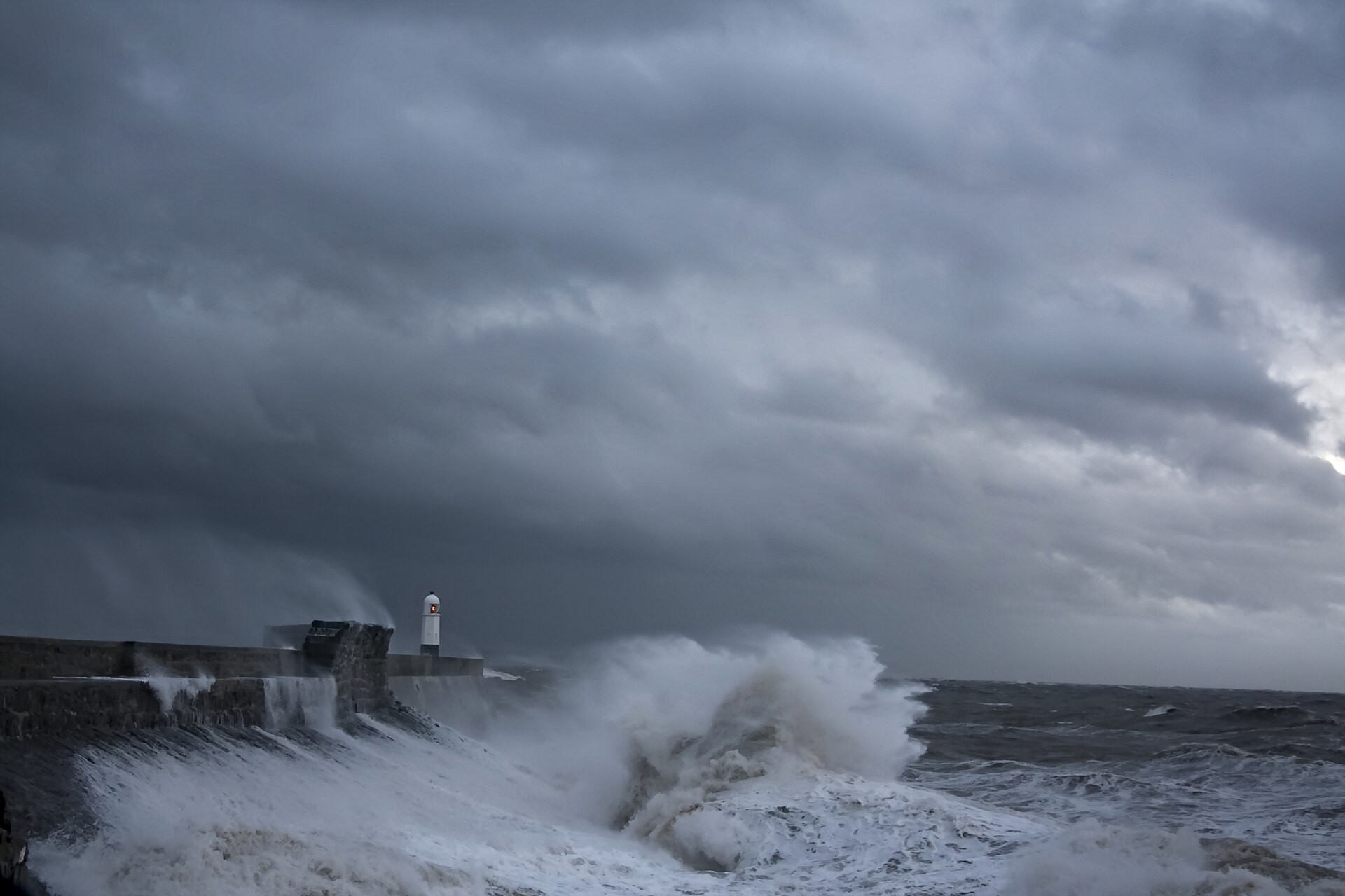
Illustrative photo: storm waves breaking over the harbour wall and lighthouse at Porthcawl, south Wales

Forecast

Storm Chloe

Forecast track and flood conditions

named by the Met Office · · 3,125 views

Porthcawl, south Wales · Jeremy Segrott, CC BY 2.0, cropped · illustrative

Where Storm Chloe could track

ECMWF ensemble

Reading the ensemble…

Median trackModel runs, coloured by how deep each gets

Each thin line is one of the ensemble's runs; the dashed line is the median of their positions hour by hour. FloodRadar's reading of the model, not a Met Office track or forecast. Forecast data based on ECMWF open data (CC BY 4.0).

Current conditions

Live flood warnings, and the areas of the Met Office's warnings for Storm Chloe.

Flood alert: Dumfries and Galloway · ScotlandFlood alert: West Central Scotland · ScotlandFlood alert: Ayrshire and Arran · ScotlandFlood alert: Tidal Fal Estuary · CornwallFlood alert: South Cornwall Coast from Lands End to Lizard Point · CornwallFlood alert: Shetland · ScotlandFlood alert: Orkney · ScotlandFlood alert: Caithness and Sutherland · ScotlandFlood alert: South Cornwall coast from Gribbin Head to Rame Head · CornwallFlood alert: Western Isles · ScotlandFlood alert: South Cornwall coast from Lizard Point to Gribbin Head excluding the Tidal Fal Estuary · CornwallFlood alert: The Essex coast from Clacton to and including, St Peters Flat and the Colne and Blackwater estuaries · EssexFlood alert: The Suffolk and Essex coast from Felixstowe to Clacton including Orwell and Stour estuaries · Essex, SuffolkFlood alert: The Essex coast from St Peters Flat to and including Shoeburyness and the Crouch and Roach estuaries · Essex, Southend-on-SeaFlood alert: The tidal Deben estuary · SuffolkFlood alert: The Essex coast at Coalhouse Fort · ThurrockFlood alert: Wye Estuary in Gloucestershire · GloucestershireFlood alert: South Devon Estuaries · DevonFlood alert: North Devon coast from Hartland Point to Lynmouth · DevonFlood alert: Rivers Nant-Y-Fendrod and Nant Bran · WalesFlood alert: Rivers Gwendraeths · WalesFlood alert: River Severn in Shropshire · Shropshire, Telford and Wrekin, WorcestershireFlood alert: The tidal Rivers Bure, Ant and Thurne · NorfolkFlood alert: The tidal River Waveney from Ellingham to Breydon Water · Norfolk, SuffolkFlood alert: The tidal River Yare from Thorpe St Andrew to Breydon Water · NorfolkFlood alert: Upper River Ouse · North Yorkshire, YorkFlood alert: Severn Vyrnwy confluence · ShropshireFlood alert: River Cadoxton · WalesFlood alert: River Ely · WalesFlood alert: Upper River Derwent, Stonethwaite Beck and Derwent Water · CumberlandFlood alert: Rivers Brathay, Rothay and Winster · Westmorland and FurnessFlood alert: Irish Sea from New Brighton to Hoylake · WirralFlood alert: Mersey Estuary at Warrington · Halton, WarringtonFlood alert: Coast at Duddon estuary · Cumberland, Westmorland and FurnessFlood alert: Coast at Barrow in Furness · Westmorland and FurnessFlood alert: Coast from Silloth to St Bees · CumberlandFlood alert: North West Wales coastline · WalesFlood alert: Coast at North Morecambe Bay · Lancashire, Westmorland and FurnessFlood alert: Coast from Gretna to Silloth · CumberlandFlood alert: Coast from St Bees Head to Haverigg · CumberlandFlood alert: West Anglesey coastline · WalesFlood alert: Tidal Thames riverside from Putney Bridge to Teddington Weir · Greater London, Hammersmith and Fulham, Hounslow, Richmond upon Thames, WandsworthFlood alert: Coast from St Margaret's at Cliffe to Sandgate · KentFlood alert: Coast from Ramsgate to Kingsdown · KentFlood alert: Coast from Dartford to Allhallows · Bexley, Greater London, Kent, MedwayFlood alert: Tidal Medway, Medway estuary and Isle of Grain · Kent, MedwayFlood alert: Coast from Whitstable to Margate · KentFlood alert: Isle of Sheppey and coast from Kemsley to Seasalter · KentFlood alert: Southampton Water and Hamble · Hampshire, SouthamptonFlood alert: Mansbridge and Riverside Park · Hampshire, SouthamptonFlood alert: Beaulieu estuary · HampshireFlood alert: Portsmouth · PortsmouthFlood alert: Fareham to Portchester · Hampshire, PortsmouthFlood alert: Langstone to Emsworth Harbour · Hampshire, West SussexFlood alert: Isle of Wight coast · Isle of WightFlood alert: Coastal areas of Pevensey seafront · East SussexFlood alert: Selsey Bill to Elmer · West SussexFlood alert: Coastal areas of West Wittering to Medmerry · West SussexFlood alert: Argyll and Bute · ScotlandFlood alert: Easter Ross and Great Glen · ScotlandFlood alert: Findhorn, Nairn, Moray and Speyside · ScotlandFlood alert: Tayside · ScotlandFlood alert: Dorset coast at Poole Harbour · Bournemouth, Christchurch and Poole, Dorset CouncilFlood alert: Tidal areas of Littlehampton Rope Walk · West SussexFlood alert: Christchurch Harbour · Bournemouth, Christchurch and PooleFlood alert: Coastal areas of Seaford seafront · East SussexFlood alert: Aberdeenshire and Aberdeen City · ScotlandFlood alert: Climping Seafront · West SussexFlood alert: Thorney Island to West Itchenor · West SussexFlood alert: Upper River Tamar · Cornwall, DevonFlood alert: South Devon coast from Start Point to Dawlish Warren · Devon, TorbayFlood alert: Swansea Bay and the Gower coast · WalesFlood alert: Carmarthenshire coast · WalesFlood alert: Pembrokeshire coast · WalesFlood alert: Ceredigion coast between Clarach and Cardigan · WalesFlood alert: Llyn Peninsula and Cardigan Bay coastline · WalesFlood warning: Stornoway · ScotlandFlood warning: Lochmaddy · ScotlandFlood warning: Locheport · ScotlandFlood warning: Balivanich and Benbecula Airport · ScotlandFlood warning: West Benbecula · ScotlandFlood warning: Baleshare · ScotlandFlood warning: Stonehaven · ScotlandFlood warning: South Hayling and South Eastoke seafront · HampshireFlood warning: Riverside properties along the tidal River Yare including Cantley, Brundall and Reedham · NorfolkFlood warning: Isolated low lying properties along the tidal River Waveney · Norfolk, SuffolkFlood warning: Ardmore to Loch Carnan · ScotlandFlood warning: Keswick Campsite · CumberlandFlood warning: Irish Sea at New Brighton · WirralFlood warning: Bosham and West Itchenor · West SussexFlood warning: Churchill Barriers · ScotlandFlood warning: St Margaret's Hope · Scotland
Flood warningFlood alertView full map →

Wettest gauges last 24 hours

View all gauges →
  • 40.5 mm
    Very heavy rain now · 4.3 mm in the last hour
  • Llety BronguBridgend
    34.8 mm
    Very heavy rain now · 6.8 mm in the last hour
  • TavernspiteCarmarthenshire
    25.4 mm
    Steady rain now · 0.8 mm in the last hour
  • BirchgroveSwansea
    25.2 mm
    Heavy rain now · 2.6 mm in the last hour
  • CroeserwNeath Port Talbot
    25.0 mm
    Very heavy rain now · 7.8 mm in the last hour
  • Dyffryn Isaf LlantrisantRhondda Cynon Taf
    24.4 mm
    Very heavy rain now · 7.8 mm in the last hour
  • ByneaCarmarthenshire
    24.2 mm
    Steady rain now · 1.2 mm in the last hour
  • Upper LliwSwansea
    24.0 mm
    Very heavy rain now · 4.8 mm in the last hour
  • BracklaBridgend
    23.4 mm
    Steady rain now · 1.8 mm in the last hour
  • SpyteSwansea
    23.4 mm
    Heavy rain now · 3.8 mm in the last hour

"A once-a-year day here" compares the total with that gauge's own history. Rain words are the site's hourly scale, up to torrential. A gauge far wetter than every gauge near it is marked, as it may be a faulty reading.

Rainfall explorer →

Rising rivers last 24 hours

View all rivers →
  • River ArunArundel
    3.03 m
    Within its typical range Rising +2.10 m on yesterday
  • River OuseMonkton · North Yorkshire
    3.39 m
    Within its typical range +1.71 m on yesterday
  • New CutCae Howel · Shropshire
    3.36 m
    Within its typical range Rising gently +1.49 m on yesterday
  • River SwaleCrakehill · North Yorkshire
    2.76 m
    Within its typical range +1.46 m on yesterday
  • River OuseSkelton · York
    3.40 m
    Within its typical range +1.45 m on yesterday
  • Maud Foster/Stonebridge DrainSibsey · Lincolnshire
    1.83 m
    Above typical high +1.37 m on yesterday
  • River OuseClifton Ings Outfall · York
    7.55 m
    Within its typical range +1.31 m on yesterday
  • River OuseViking Recorder · York
    2.43 m
    Above typical high Rising +1.25 m on yesterday
  • River OuseYork Foss Barrier · York
    7.34 m
    Within its typical range Rising gently +1.24 m on yesterday
  • Browney DykeYork Foss Barrier · York
    7.34 m
    Above typical high Rising +1.24 m on yesterday

Rising now (live rates) →

Latest coverage

Headlines that name Storm Chloe, and FloodRadar's flood news.

From a UK news search for the storm's name and FloodRadar's flood news. Nothing about the storm is taken from a headline.

FloodRadar compiles official warnings, gauge data, model forecasts and public reporting. It is not an emergency service and does not replace official flood warnings: always follow official guidance during a storm. Page built 11:45.